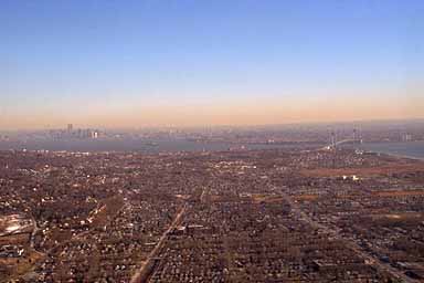
New York has a Hudson River corridor which gets you through the area with a minimum of fuss. We want the minimum of fuss, plus the sights should be interesting.

Approaching New York. Toward the right edge of the photograph, you can see the Verrazano Bridge. That's the edge of the airspace we need to be talking to NY Approach on. The frequency is very congested, I'm still trying to navigate and figure out how exactly we're going to get through the airspace.
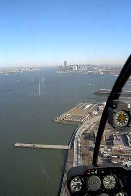
Finally we're into the corridor, talking to the one other helicopter that is out. Far from being very busy as we expected, there is no traffic at all. It's only 9:30am on a weekday, so that probably explains a lot.
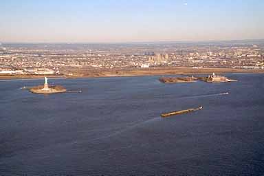
Looking toward the west side of the river (New Jersey) you can see the Statue of Liberty, and Ellis Island. Back in the days of mass immigration to the USA, Ellis Island was a quarantine area for arriving immigrants.
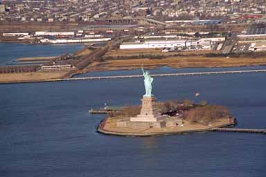
A closer view of the Statue of Liberty. You can tell we want to get home bad, because we don't even try to get any closer to it than this. You'd think we would have at least circled it once!
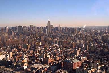
Downtown Manhattan, with the Empire State Building commanding the skyline. We stop at Westchester for fuel at 10:00. Back in the air, headed for Bradley Airport in Hartford Connecticut.
After a quick fuel stop in Hartford, we stop in at Palmer Airport to see our friend Jack. Jack runs the local Life Flight organization out of University of Massachusetts in Worcester. They pre-position several aircraft so that they can minimize the time it takes to respond to an emergency call. Jack is the local designated examiner, which means you take your pilot checkrides and your CFI renewals with Jack. He's one of those guys that every time you fly with, you learn something new...
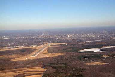
After a half hour or so, we're back in the air and flying over Worcester Airport. This is about 10 miles from Sterling Airport, where I learned to fly and used to instruct, so it was a common place for me to fly at with students. I still fly there a few times a year. Worcester is a strange airport because it's at 1,000 feet, while the surrounding countryside is more like 300 feet above sea level. When all the other airports are good VFR, Worcester is often in the clouds, zero zero. Also, because it's up so high, there is always a lot more wind at Worcester than any of the other airports. We go there for practice autorotations to take advantage of the wind...
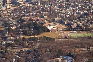
Getting closer to home, we happen to fly over the college I went to, Worcester Polytechnic Institute, where I studied Computer Science during the WPI Golden Age of Hacking. Above and to the left of the football field are a group of brick buildings which make up the place. It's a small school...
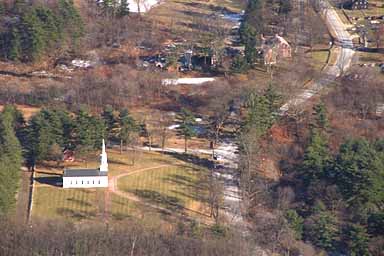
Since I left my car at home (took a limo into Logan Airport when I left) I ask Anne to drop me off in my town. I have a friend who owns a local business and a couple helicopters, and he lets me land at his place when I need to. So we head for Sudbury and I snap this picture of the Martha Mary Chapel, where I was married. It was built by Henry Ford, of automobile fame (he and his family used to live in our town). Up and to the right, mostly hidden in the trees is Longfellow's Wayside Inn, the oldest operating Inn in the United States, which was restored by the Fords. It was made famous by a poem of Henry Wadsworth Longfellow, thus the name.
Two minutes later I'm on the ground catching a ride to my house. Here are the stats for the flight:
Nine Days Elapsed Time
42.2 hours of flight time
Straight line distance: 2250.5nm
Distance as flown: 2759.9 (510 extra miles)
Average Speed: 66 knots
Fuel Burned: About 325
Mileage8.4 nm per gallon